Search This Blog

Monday, September 28, 2015

Grand Ferry Park

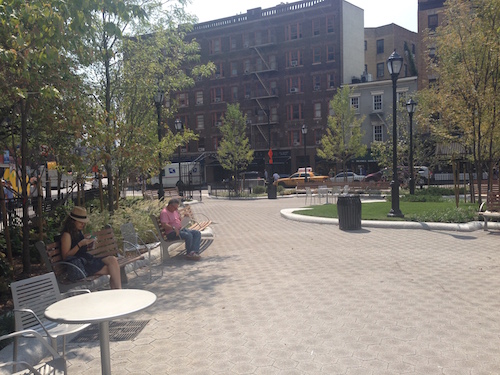
It may not be grand, and no ferry stops there at present, but Grand Ferry Park bestows charm and individualism to its stretch of the waterfront in Williamsburg, Brooklyn.

grand ferry park williamsburg brooklyn nyc

Once there was a ferry landing here. From 1812 until 1918 the Grand Street Ferry carried farm goods and passengers across the East River, between Grand Street in Williamsburg and Houston Street in Manhattan. (Click this link for an 1847 map showing the route.)

Then spelled Williamsburgh, the area was chartered as a city in 1852, and became part of the City of Brooklyn three years later. All through these changes the ferry rocked on.

grand ferry park williamsburg brooklyn nyc

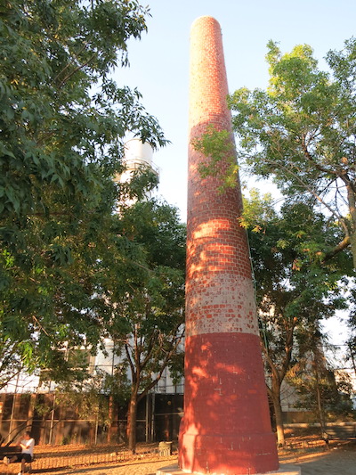
Long abandoned but remaining accessible to the public, it became an unofficial park in the 1970s before opening as an official city park in 1998, incorporating elements from the site’s history, such as a red brick smokestack that had been part of an early-20th-century Pfizer Pharmaceuticals molasses plant.

grand ferry park williamsburg brooklyn nyc

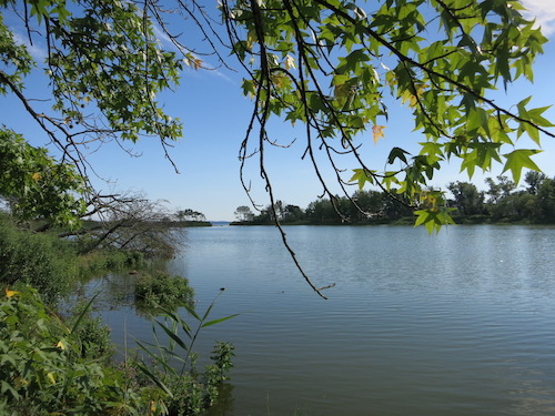
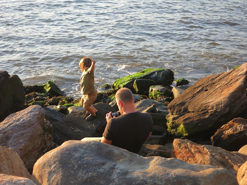
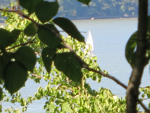
Relics of the ferry landing are visible in the water, with Manhattan across the way. The Empire State Building is near the center of this photo, behind the stacks of Con Edison's power plant at 14th Street. (Hurricane Sandy caused a rather spectacular transformer explosion there, knocking out the power in my neighborhood for four days on that memorable occasion.)

grand ferry park williamsburg brooklyn nyc

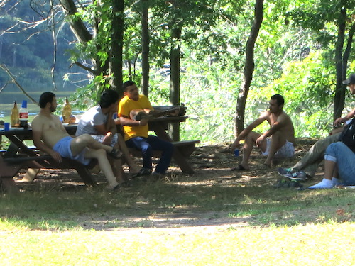
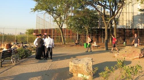
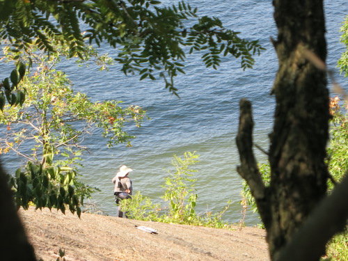
Shortly before sunset on the day I stopped by, the park's clientele was a mix of family types, Hasidic Jewish men, and Williamsburg hipsters.

grand ferry park williamsburg brooklyn nyc

I really appreciate the focus on gravel instead of grass. Grass can hide too many sins. And it's unnatural.

grand ferry park williamsburg brooklyn nycMuch better, if you ask me, is what was done during the park's 2008 landscape reconstruction, funded in part, as the Parks Department website explains, "by the New York State Power Authority, in connection with their new plant just north of the park.

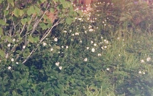
"As part of the wetlands requirements for this waterfront parcel, mandated by the Department of Environmental Protection, these new plantings show an emphasis on native species of trees, shrubs and perennials. Native tree species include varieties of dogwood (Cornus), American holly (Ilex opaca) and river birch (Betula nigra)" which joined pre-existing pines, honey locusts, and white ash trees "which bring," as the Park Department so gracefully describes it, "shade and elegant leafage to the site." Somebody over there knows how to write good marketing copy.

Native shrubs "chosen for their ability to withstand the wetlands, brackish air and windgusts of this littoral environment" were also planted. ("Littoral." Nice touch.)

Europeans of the 19th-century Romantic era loved to visit, sketch and paint picturesque ancient Greek and Roman ruins. I like to photograph picturesque sites of abandoned commerce.

grand ferry park williamsburg brooklyn nyc

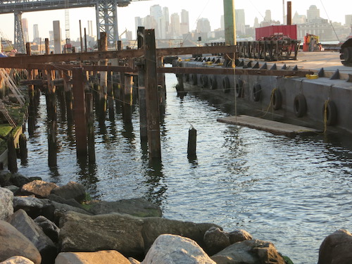
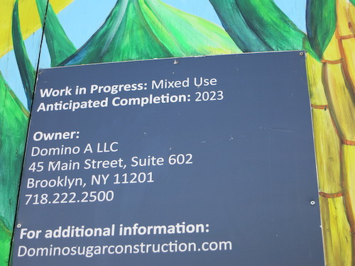
I wonder what will become of those relics when work is completed on the erstwhile Domino Sugar Factory next door.

grand ferry park domino sugar factory williamsburg brooklyn nyc

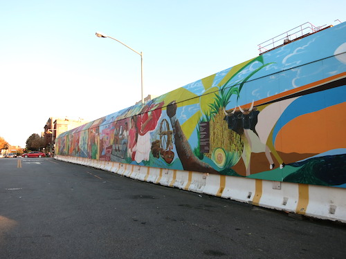
I guess we'll find out in 2023. (Because as any New Yorker can tell you, our construction projects always finish right on schedule.)

grand ferry park domino sugar factory williamsburg brooklyn nyc

All photos © Jon Sobel, Critical Lens Media

Friday, September 18, 2015

Hudson Yards Subway Station Plaza

The last thing I expected when we headed to the Jacob K. Javits Convention Center the other evening was to discover a new park. But there's a new plaza by the new Hudson Yards subway station, a station that opened last Sunday, though not without some squabbling. Little remarked in all the news coverage of this long-awaited extension of the 7 train was the new plaza, which, while it may not have a name, sure resembles a park.

hudson yards subway 7 train manhattan nyc

On the north side of 34th Street, across from the fancy new station entrance, the fountains were attracting small crowds.

hudson yards subway 7 train manhattan nyc

I took these photos the very day the station opened after a decade of planning and a two-year delay. It will serve the future commercial and residential communities of the huge Hudson Yards development, a gaggle of large buildings rising atop the train yards, as well as attendees of Javits Center events.

Later that evening on the way home we rode the 7 train from here, just so we could say we'd used the station on its first day.

The station entrance itself, on the south side of 34th, has parklike landscaping too, with little trees, curved walkways – even benches, for crying out loud.

(I mean that literally. I'm certain people will sit on those benches and cry out loud. People having huge public fights with their significant others. People who are homeless and/or mentally disturbed. People who just spent a whole day going to panel discussions at a convention at the Javits Center.)

hudson yards subway 7 train manhattan nyc

Even without a new subway, the Javits Center surroundings have always offered dramatic sunsets. For crying out loud.

hudson yards subway 7 train javits center manhattan nyc

In closing, let me suggest that if the plaza really doesn't have a name, we should dub it Odyssey Park or Odyssey Plaza in honor of the blog you are reading right now. Smile and nod if you agree.

Tuesday, September 15, 2015

Fort Washington Park, Revolutionary War Redoubt, and Hudson River Greenway

Everyone knows about the George Washington Bridge, but for a long time I didn't know that every time I drove over it I was, for a few moments, high above a park of significant historical interest.

I had actually unknowingly been to Fort Washington Park before. Back when I kept a bicycle, I biked up the Hudson River path a couple of times as far as the Little Red Lighthouse, which stands like a beacon of another time in the shadow of the Great Grey Bridge.

little red lighthouse manhattan nyc
The Little Red Lighthouse, also known as the Jeffrey's Hook Lighthouse

I didn't realize the lighthouse stood in a separate park until I recalled reading in the papers a few years ago about a Revolutionary War redoubt that was said to lurk in the scraggly woods under the Manhattan side of the George Washington Bridge – in Fort Washington Park. Of course, we had to see it.

george washington bridge manhattan nyc

Fort Washington itself was on higher ground, the highest point in Manhattan in fact, where Bennett Park is today. There are no remains of the fort visible there. But Washington's troops needed a spot closer to the river, someplace in weapons range of British ships passing up the Hudson. So they built an earthworks – a redoubt – from which they could fire on the river in relative safety. This redoubt is still there.

You'd think the sole remaining Manhattan relic of the War for Independence would be a much-visited attraction. But it's hidden away at the end of an unmaintained trail through a woods littered with trash presumably thrown from the Great Grey Bridge. To get there we entered Fort Washington Park on its eastern side, by Riverside Drive.

I took the above photo of the bridge from the little observation deck atop the old wall in the next photo. The graffiti-bedecked staircase is blocked off and overgrown. I guess we irresponsible New Yorkers couldn't be trusted on it.

riverside drive manhattan nyc

You can enter the park across Riverside Drive.

fort washington park manhattan nyc

A wooden footbridge takes you over the train tracks into the main body of the park.

fort washington park manhattan nyc

Then as you walk along the main path, almost before you know it you'll come upon the trail to the redoubt, on your left. Provided you're looking for it, that is. If not, you'd probably walk right by.

fort washington park manhattan nyc

After walking alongside the tracks for a short distance you come to a big boulder.

fort washington park manhattan nyc

Fortunately you don't have to scramble up it. This Newsday article from 2011, which gives a good quick summary of the wartime history of the site and environs, said you have to "climb a large rock by scaling its left side," but you don't actually have to rock-climb. Just walk around to its left and scramble up to the top via a steep trail.

And there it is: the redoubt! The Daughters of the American Revolution topped it with a memorial pillar of unworked stone way back in 1910.

fort washington park revolutionary war redoubt manhattan nyc

The monument reflects an obsolete spelling of the word: "redout." From the Latin reductus, "a secret place, a refuge," the word is documented in the OED dating back to 1608, spelled "redoubt." The spelling without the "b" seems to have been an alternate spelling all along, but no longer in use in modern times. (As to how the English word "doubt" got a "b" in it in the first place, that's a subject for another day, and a completely different blog – one I'd love to write given infinite time.)

fort washington park revolutionary war redoubt manhattan nyc

Peering through the trees at the Hudson River, I could envision the troops keeping watch for British boats, ready to take aim if need be.

fort washington park revolutionary war redoubt manhattan nyc

No, it's not a very big site. But shouldn't it be more publicized? More visited?

I actually have mixed feelings about that. There's something fun about tracking down nearly-forgotten sites with historical significance, places sought only by explorers and history buffs. It's also nice to find, in our litigious and hyper-regulated mommy-state, something ill-maintained yet still accessible. I almost hesitate to post this on the blog, fearing to draw harmful attention to the site.

But only almost. And so, climbing back down to the main path, we made our way through the park to the Little Red Lighthouse and then headed south through the remainder of Fort Washington Park and along the Hudson River Greenway.

fort washington park manhattan nyc
little red lighthouse manhattan nyc
fort washington park manhattan nyc

I'm not sure where Fort Washington Park ends, but the tennis courts seem to be within its confines. Then, at some point, you're just on the Hudson River Greenway.

fort washington park tennis manhattan nyc
hudson river greenway manhattan nyc

The George Washington Bridge looks majestic from any vantage point.

george washington bridge manhattan nyc

But my final impression before we headed out of the park at 158th Street to find lunch in the southern reaches of Washington Heights – everything up here's named after the Father of Our Country, you'll notice – was of the greenery hanging over the railroad tracks. It looks like you could almost be in a rain forest.

hudson river greenway manhattan nyc

All photos © Jon Sobel, Critical Lens Media

Saturday, September 12, 2015

St. Vincent's Park - 76 Greenwich Avenue

Manhattan's newest park is open, but it may not officially be a park yet.

It's hard to tell from the non-Parks Department sign, which mentions only the address of the adjoining building, 76 Greenwich Avenue. But a quick web search turned up a public letter on the city government website calling for transferring this newly landscaped open-space triangle to the City and naming it St. Vincent's Park.

The letter, from Community Board #2 to the City Planning Commission, explains that "This park was part of the deal made in 2011 by the Rudin Management. The developer promised to build a public park on this triangular plot of land as part of the approval to convert the old St. Vincent's Hospital site into condos."

A visit tells the story: The public park has been built.

st vincents park 76 greenwich avenue manhattan nyc

It has a fountain (complete with picturesque children playing in it), benches (complete with a sleeping man), tables and chairs, and, according to the sign, 36 trees and 19 light poles.

st vincents park 76 greenwich avenue manhattan nyc

Evidently, though, it's still awaiting transfer to the Parks Department. Or at least new signs.

st vincents park 76 greenwich avenue manhattan nyc

A replacement for St. Vincent's hospital, which closed a couple of years ago amid enormous controversy, it is not. Still, it looks like a nice little addition to the neighborhood.

st vincents park 76 greenwich avenue manhattan nyc

All photos © Jon Sobel, Critical Lens Media

Tuesday, September 8, 2015

Wolfe's Pond Park

wolfes pond park staten island nyc battle of the bulge
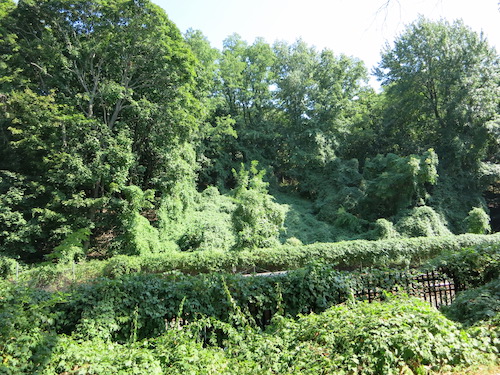
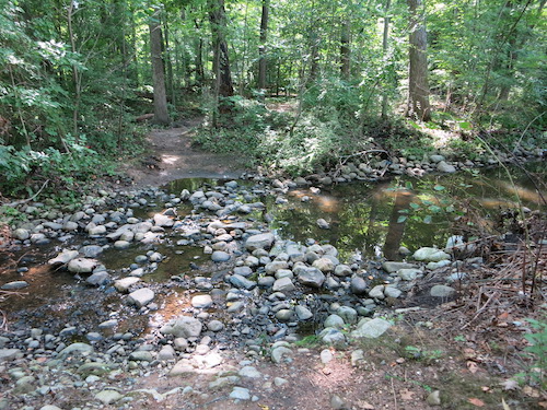
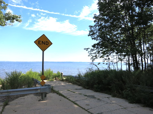
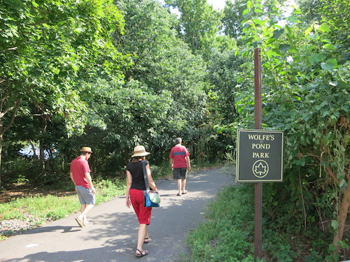
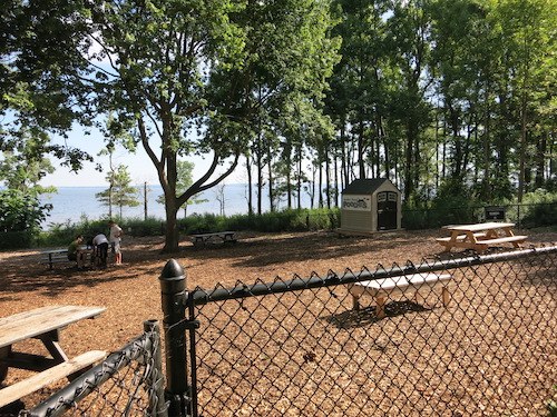
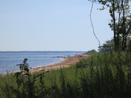
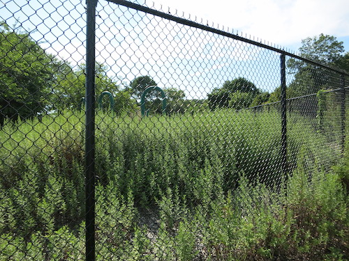
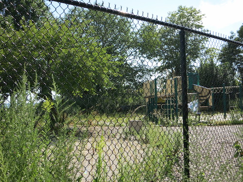
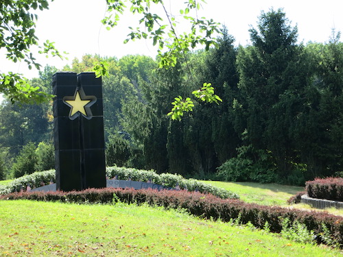
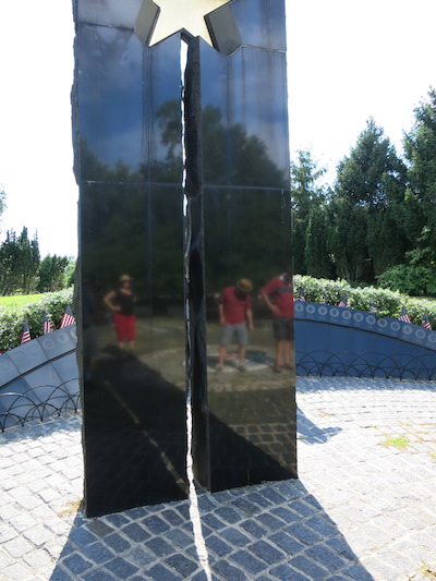
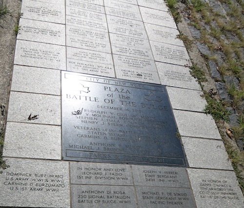
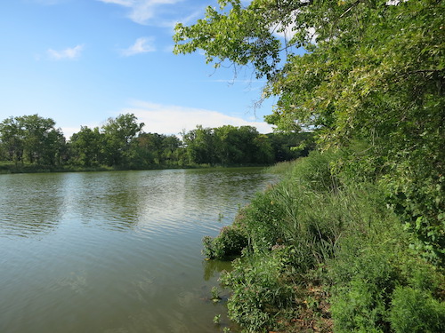
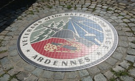
With a beach, freshwater ponds, a forest, lots of recreation facilities, and even a Battle of the Bulge memorial, Wolfe's Pond Park covers more than 300 acres on the south shore of Staten Island, split across the middle by Hylan Boulevard, one of the island's main thoroughfares. The park includes part of the Staten Island Bluebelt, a huge storm drainage and landscape architecture project that's still in progress.

A Bluebelt sign greeted us as we made an initial stab into the park from its northern end, thinking we might be able to find paths all the way through to the pond and the shore.

wolfes pond park staten island bluebelt nyc

The trail was clear, but with neither a map nor the right footwear for the terrain, we decided to drive down to the beach end instead.

wolfes pond park staten island nyc

If you see berries that look like the ones in the next photo, do not eat them. It's pokeweed. Pokeberries are deadly poisonous to humans, although, according to Outdoor Life, birds and deer and other animals can eat them with no problem.

wolfes pond park staten island nyc

Can dogs eat pokeberries? Outdoor Life doesn't say. They can have a good time in the Wolfe's Pond Park dog run, though. Because of the clean-looking wood-chip surface (and the absence of dogs) I didn't even realize it was a dog run until I noticed the POOCHES sign on the shed.

wolfes pond park staten island nyc

Walking a winding path through the high shrubbery gave us our first view of the beach, which looks pretty nice, even though this summer a New Yorkers for Parks report rated it the worst of eight city beaches. (Like other Staten Island beaches, it suffered damage during Hurricane Sandy.)

wolfes pond park staten island nyc

Basketball courts, tennis courts, even a hockey rink were in use. Absolutely not in use was this fenced-off, overgrown playground . The equipment doesn't look old. Hurricane Sandy shut off the "lights" here, I believe. There's a notation on the parks department website that restoration of the playground and surrounding paths is underway.

wolfes pond park staten island nyc

Out of nowhere the Plaza of the Battle of the Bulge appears, with its striking memorial. Its dichroic glass star is said to change color throughout the day.

wolfes pond park staten island nyc battle of the bulge

Partly funded by contributions from Luxemburg and Belgium, the memorial, built in 2001, pays "tribute to the 600,000 American men and women who participated in this epic [1944-45] battle," as the Parks Department website explains.

wolfes pond park staten island nyc battle of the bulge

We made our way towards the pond itself across a big grassy area strewn with families and groups of friends. There seemed to be roughly as many ethnicities as groups.

wolfes pond park staten island nyc

At last, Wolfe's Pond.

wolfes pond park staten island nyc

The city acquired the area for a park in 1929, but it was already a popular spot for waterside recreation. Prior to that it was owned by the state, which used it as a quarantine site for sick immigrants. Before that, a man named Joel Wolfe who had come up from Virginia farmed it until 1857 (credit goes to an old Forgotten New York post for that hard-to-find tidbit). And before that, Native Americans used the shells of the Quahog clams they found here (later given the wonderful scientific name Mercenaria mercenaria) to make valuable wampum.

The freshwater pond extends south to where, pace the little dam, it sometimes connects to Raritan Bay – and floods with seawater. How fresh, salt, or brackish is the water this summer I have no idea.

wolfes pond park staten island nyc

Looking northward, you could almost be in a pristine wilderness.

wolfes pond park staten island nyc

Looking at children chasing geese, well, it's a wild scene, but maybe not so pristine.

wolfes pond park staten island nyc

One goose had found a more protected spot. Though if it came down to a real fight, I suspect the children would need more protection than the geese.

wolfes pond park staten island nyc

These guys had secured a quiet little eden too, a shady spot by the water where they listened to one of their number sing and play a stringed instrument. Is this a saz? If anyone knows for sure, please let me know in a comment below.

wolfes pond park staten island nyc