Search This Blog

Wednesday, June 19, 2013

Soho Square, Father Fagan Park, and Avenue of the Americas

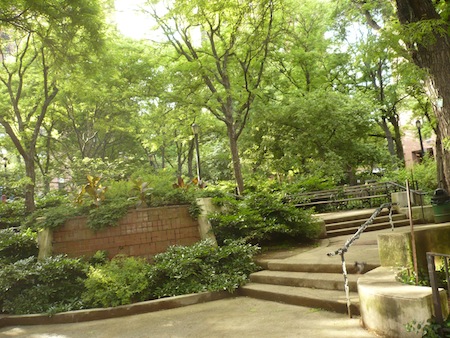
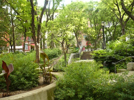
There's a string of small gardens and parks that decorate Sixth Avenue, otherwise known as Avenue of the Americas, in the West Village. From north to south, there's the Jefferson Market Garden, Minetta Green and Minetta Triangle, Father Demo Square, and Winston Churchill Square. There's also Little Red Square, named not for the Moscow landmark but (presumably) for the adjacent Little Red School House.

The sequence doesn't stop when you continue further south into Soho, because Avenue of the Americas down here refuses to line up precisely in parallel with the streets to its west and east, giving rise to lots of wee triangles too small for buildings.

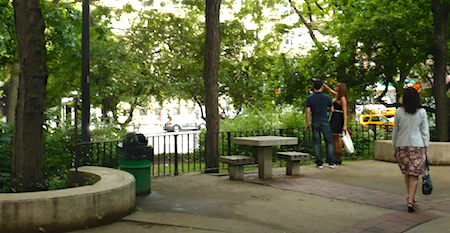
Down here on the Soho stretch there's nothing with the green density of the Jefferson Market Garden or Minetta Green, but there is, to begin with, the sliver of a triangle known as Charlton Plaza, which I've documented before. Even though it isn't a park, and not even remotely a "plaza," I like it because of its startling narrowness. I note it again today because when I walked by the other day I saw, for the first time, its gate open.

No one was inside that I could see, and, fearing transformation into a Flatlander, I didn't venture in. On the far left, you can see a woman tending the vegetation, but doing it from outside the fence – seems she knows about that sinister Flatland possibility too.

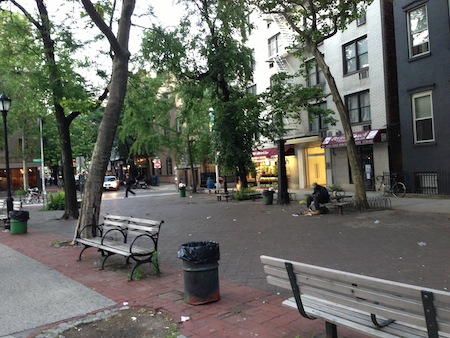
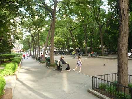
Across the street on the next block, a slightly wider but much less green triangle known as Father Fagan Park doesn't seem to get much use. Those passing through doubtless give little thought to the 27-year-old Franciscan priest who gave his life to rescue two colleagues from a fire at his Thompson Street rectory in 1938 before lending his name to this space. Plaques also honor three firefighters who died in the line of duty at another nearby blaze in 1994.

The tree partially visible on the left, with leaves obscuring the sign, is one of the three callery pear trees planted here that same year.

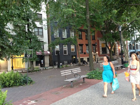
Seen from the southern end at this early evening hour, Father Fagan Park looks none too appetizing, for sure.

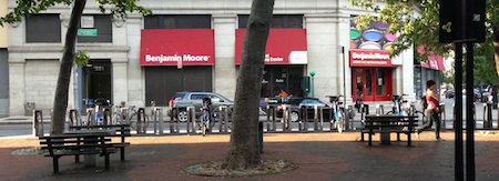
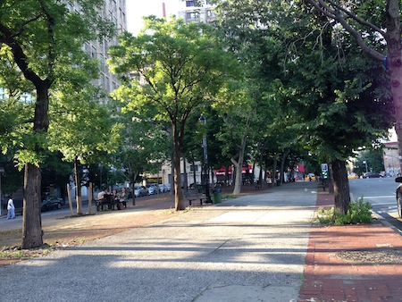
A little farther south you hit Soho Square (not a square but, of course, a triangle), which is larger and more inviting. The northern fringe now hosts a Citi Bike station, one of the few that was positioned sensibly (that is, not taking up valuable parking spaces). On this occasion, you can see that most of the bikes are out, rented. In spite of all the technical problems with the city's new bikeshare program (and the cranky old bats blasting it with unhinged fervor), many's the time I walk by a station with almost all the bikes gone, and I see people riding them around Manhattan all the time, so by that early measure, it's a success.

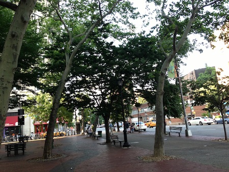
Is Soho Square a park? Well, I see the Parks Dept. leaf logo on the sign. There's no grass to speak of, but plenty of trees and benches, and a red-and-black paving pattern that sets it off from its surroundings. So I give it the benefit of the doubt and tally it up as a park.

If you're wondering why Sixth Avenue was renamed Avenue of the Americas – or, to be more realistic, 
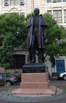
why it was given that alternate name – just walk down the southern section and you'll find monuments to figures from Latin American countries. At the southern end of Soho Square, near where its scalene triangle tapers to a point, you'll find General José Artigas, "National Hero of Uruguay," a cattle smuggler turned guerrilla warrior who became "the father of Uruguayan nationhood." This statue is a cast of an original by José Luis Zorrilla de San Martín that stands in Montevideo, and the base – here's a piece of unusual trivia – is of Uruguayan granite.

So, while Avenue of the Americas doesn't actually extend south into any other Americas, you can wander along it and acknowledge some of their heroes, while partaking of the Pan-American spirit that gave Mayor LaGuardia that crazy street-renaming idea in the first place.

Sunday, June 9, 2013

Ruppert Park

Just when I think I know all the parks in Manhattan, suddenly a shady grove crops up and proves me wrong.

Colonel Jacob Ruppert was a congressman, brewer, and co-owner of the New York Yankees. In 1919 he and a partner bought the Astor estate in the Bronx and proceeded to build Yankee stadium there. They were also responsible for buying Babe Ruth's contract from the Red Sox. Safe to say Ruppert was into some pretty historic stuff nearly a century ago.

But where his name really lingers is at Ruppert Park, which sits in Yorkville on the Upper East Side, right where Ruppert's father established the Jacob Ruppert Brewing Company just after the Civil War.

The "Germanity" of this formerly German-American neighborhood has dwindled to little more than a few business and place names, "Ruppert" being one. The park was created adjacent to the Ruppert/Yorkville Towers back in 1978-79 under pressure from the community. The Parks Department took over and improved the park in 1997, and today it's a small and rather lonely but very appealing green beacon in a sea of high-rises, in spite of the controversial loss not long ago of one of its playground areas to further high-rise development.

In fact, Ruppert Park is so dense with trees that Google's satellite view provides no clue that it houses playgrounds, non-trivial terrain, landscaping, and a fountain. In June all you see from above is the dense green of the trees. But inside this city grove you can sit and contemplate, walk, and with some imagination even do a miniature wander.

Outside the park I found an unexpected avenue (in the old sense of the word meaning a way lined by trees) between Second and Third Avenues, a good way to extend your untroubled-by-traffic walk if you so desire.

Back in 1991 this peaceful, pedestrian-only block of 91st Street was named "James Cagney Place." I haven't discovered why, unless it has to do with the coincidence of Ruppert's association with the Yankees and Cagney's famous portrayal of George M. Cohan in Yankee Doodle Dandy, which seems pretty far-fetched. If anyone knows, please leave a comment below. Cagney was a New Yorker through and through, but didn't have ties to this neighborhood that I know of.

He does now.

Wednesday, June 5, 2013

Pier 44 Waterfront Garden

Regular readers know that this blog project isn't only about parks administered by the New York City Department of Parks and Recreation. My intention is to visit every park within the city limits, whether it's a city park, a state park, a private park, or anything else. All it has to do to count as a park for my purposes is have a name, be bigger than a traffic island, and offer "passive recreation" (that is, it can't be just playgrounds or playing fields).

Though the vast majority of the places I document are New York City parks, two of the parks I recently visited in Red Hook, Brooklyn fall under the rough rubric "private park." I've already described Erie Basin Park, which was created along the water by Ikea when that giant box landed on and blew away the old Todd Shipyard. The second private park, and the final stop on this Red Hook mini-odyssey, is another waterside park hidden away behind a big store: Pier 44 Waterfront Garden, a grassy area nestled picturesquely beside Fairway Market's overflow parking lot.

Opened in 2004 with funding from local developer Greg O'Connell, the Garden is the docking station of the quirky Waterfront Museum, a preserved 1914 barge that's worth a visit on its own.

But its waterside setting and sense of peace give the park its own raison d'être.

A Curbed essay reported last fall that the park didn't appear on Google Maps, but if it didn't then, it does now. Sooner or later Google gets everywhere, doesn't it? (Usually sooner.)

Someone else who seems to get everywhere, at least in this neighborhood, is our friend Greg O'Connell, the developer. Just now I did a Google search for "red hook brooklyn." Look at what (who) popped up when I moused over the pin on the resulting map. Coincidence? (I hadn't even posted this yet.) Or is Google reading our thoughts? Resistance is futile…

We took the water taxi back to Manhattan from the adjacent Fairway Market dock, but not before one final adventure. As the ferry pulled in and unloaded its passengers, one crew member disembarked to wrangle the people waiting to board. All of a sudden the boat backed away from the dock and started heading back across the river, leaving its crewman behind.

After a minute or two, and lots of yelling, the pilot realized his or her mistake and came back for us. Never a dull moment on the high seas of Gotham!

Monday, June 3, 2013

Louis Valentino, Jr. Park and Pier

The high point of our recent mini-odyssey through Red Hook was a sweet waterfront spot called Louis Valentino, Jr. Park and Pier, named for a firefighter who died in the line of duty in 1996. The spot has been a city park since 1999, but known to me only since May 2013, and I'm glad I made its acquaintance.

Historic buildings from the time of the shipping industry have their own picturesque quality.

Back in the 1920s, according to Wikipedia, Red Hook was "the busiest freight port in the world." According to the same entry, though, in 1990 LIFE named the neighborhood "the crack capital of America."

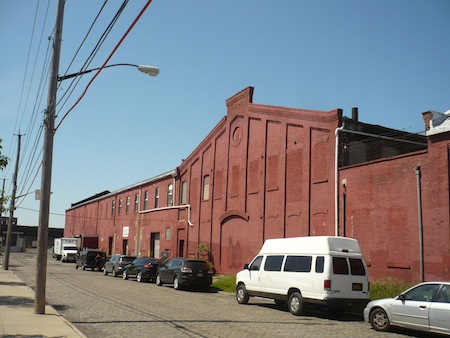
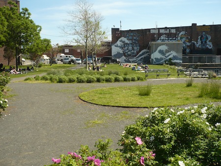
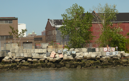
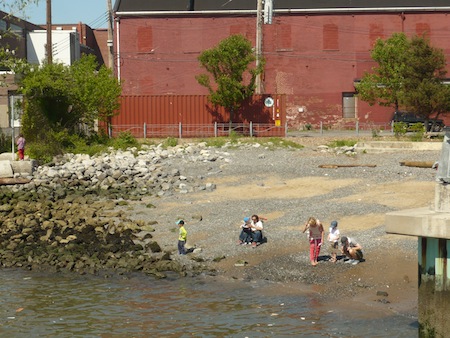
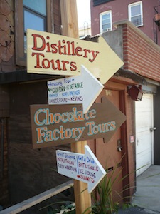
How things do change. And change again. Walking around Red Hook today, you could almost think you're in a hipster tourist town. Follow the signs to the artisanal fun!

In Louis Valentino, Jr. Park is another kind of sign, a historical one that tells us about General George Washington's Fort Defiance, which was located on a nearby island. That garrison didn't have a long life, of course, since the British occupied New York City in late 1776. Still, General Nathanael Greene (one of the Continental Army's few real generals of distinction) called it "a post of vast importance."

Gunfire from the fort's three island redoubts did cause damage to British ships, though the sign indulges in what smacks of hyperbole when it lauds their efforts as "enabling the Americans to escape and fight again, ultimately defeating the British and securing independence." Still, I'm perfectly willing to grant the history-conscious Parks Department marketing team some leeway in expressing their pride in New York City's too-often-forgotten importance in the Revolutionary War. A final note on the fort: though it is centuries gone, we ended our excursion a little later at a local house of food and mixology called Fort Defiance. Bottoms up!

There's no island now; I suppose it has since sunk beneath the waves like Atlantis. But there's nice landscaping:

And the main attraction: the pier itself, with views of islands that still do exist, like Governor's Island and Liberty Island. And Manhattan Island.

Looking back from the pier you can see playfully jumbled giant cement blocks – jumbled on purpose, I assume – for kids to play on (look to the far right) and residents to gaze at as they reflect on how cool they are for living in Red Hook, the Land the Subway Forgot.

Finally, there's the "beach." "No diving," warns yet another sign as you set foot on the pier. 'Nuff said.

We visited yet one more Red Hook park on this day before adventuring back across the deep, so stay tuned for the final installment.