Search This Blog

Wednesday, July 27, 2016

Fairview Park

There are well-known, well-traveled parks; there are unfrequented gems, and unexpected green spaces hidden away; and then there are mysteries like Fairview Park in Staten Island. I spotted it on Google Maps only because it's near Killmeyer's Old Bavaria Inn, where we went for a late lunch after our recent visit to Conference House Park. Unmarked and generically named, it beckoned from the iPhone screen like one of Star Trek's strange new worlds.

We approached via Englewood Avenue, an obscure lane that juts east off Arthur Kill Road, passes a small batch of houses, and peters out at the edge of a grassy field which, judging from the lawn furniture, locals use as a backyard.

fairview park staten island nyc

Fairview Park is an as-yet undeveloped "nature area" of some 42 acres in the Charleston neighborhood, near Staten Island's western edge. The Parks Department website has a page for it. The page says nothing. And nothing is pretty much what you get.

Facing away from the rustic barrier, all you'll see is a nondescript, grassy woods road.

fairview park staten island nyc

The day's intermittent light rain had turned spiderwebs into dizzying abstractions.

fairview park staten island nyc

We followed the woods road for a short distance. It did indeed seem to lead precisely nowhere.

fairview park staten island nyc

Sounds of human activity in the fuzzy distance spooked us, and we elected not to follow a rough path that diverged from the woods road – which seemed to be coming to an end anyway.

fairview park staten island nyc

Since at least early in the Bloomberg era, Fairview Park has been slated for recreational development. This 2013 editorial in the Staten Island Advance refers to it as "the future site of Fairview Park." (Until you get a sign with your name on it, you're not really a park.) But just last month, SILive reported that money had been allocated to get things started. Fairview Park is to include "a new library [what's a park without a library?] and several athletic areas, including bocce courts, multi-use trails, a multi-purpose field, natural trails, tennis courts, pickleball courts, horse shoe courts and a baseball field."

Pickleball? Look it up. I did. When the construction is done – purportedly by 2020 – I'll meet you there for some pickleball.

All photos © Jon Sobel, Critical Lens Media

Saturday, July 23, 2016

Conference House Park

conference house park staten island nycThe American Revolution had already begun when a delegation from the Second Continental Congress sailed up from Philadelphia to meet with British Admiral Howe on Staten Island for a last-minute attempt at a peace agreement on September 11, 1776. The members of the delegation: John Adams, Benjamin Franklin, and Edward Rutledge.

The result: failure. The war was already underway, and in any case Howe lacked the authority to meet any of the terms the colonials might have been prepared to accept.

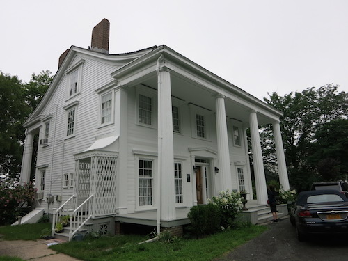
Nevertheless, they met for a couple of fruitless hours at Billopp House, also called Bentley Manor, near the southernmost point in Staten Island. Which also happens to be the southernmost point in New York City. And in New York State.

conference house park staten island nyc

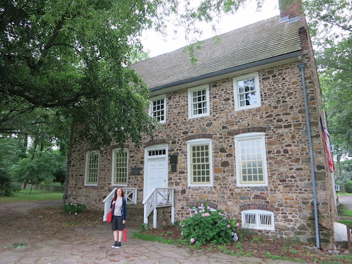
Captain Christopher Billopp, formerly of the Royal Navy, had built the handsome Dutch-style manor house around the late 1670s. His descendants still lived there at the time of the Revolution. But they were loyalists, and when hostilities broke out they fled north, taking all their possessions. The house took on various uses over the next two centuries. Now restored and stocked with period furniture and decor, it's open for guided tours. Only one item, a wooden chest, remains from the Billopps' household.

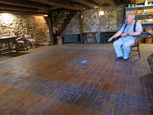
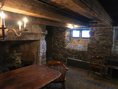
In the next photo, the dull-colored bricks in the foreground are original to the basement floor. The brighter ones in orange and blue were shipped from Holland for the house's 20th-century restoration. The white brick in the center was laid personally by the Queen of the Netherlands, if I recall correctly what the docent said (which I very well may not).

conference house park staten island nyc

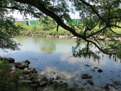
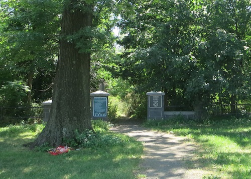
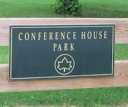
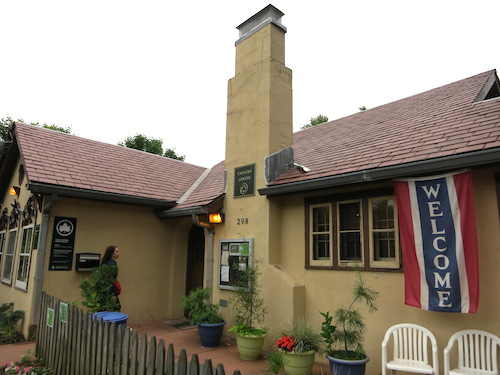
We traveled to Conference House Park last weekend (see the Conference House website for visiting hours) to see the house and explore as much as we could of the park, 286 acres of waterfront space full of surprises.

The Visitors' Center isn't one of them. But it has useful information, art and photography exhibits, and bathrooms.

conference house park staten island nyc

The first surprise when we entered the park proper, before we'd even gotten to the Conference House itself, was our greeter, a groundhog who shuffled in and out of the forest just inside the park's main entrance.

conference house park woodchuck groundhog staten island nyc

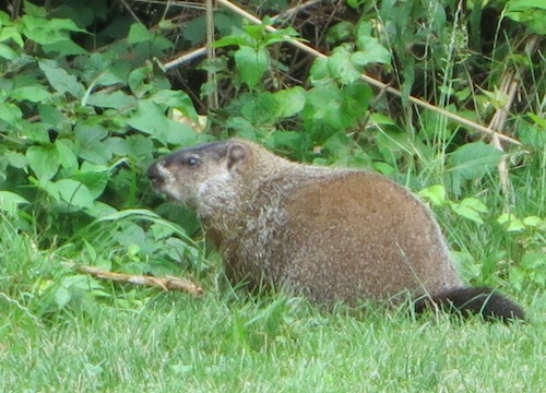
Did you know that a groundhog and a woodchuck are the same thing? I didn't – though it explains why Punxsutawney Phil's New York City analogue is named Staten Island Chuck. And did you know that these rodents are also called "whistle-pigs" because they whistle a warning to their buddies when alarmed? I didn't. WhistlePig is also the name of a Vermont whiskey distillery. And maybe the name of my next band.

Yet another name for the Marmota monax, Scientific American tells us, is the less-creative "land-beaver." (I don't think anyone around here calls them that, though. And I wouldn't be surprised if the groundhogs considered it an insult.)

Groundhogs are native to this part of the U.S., so I suspect there was an ancestral population on Staten Island in 1776 when the famous conference occurred.

conference house park staten island nyc

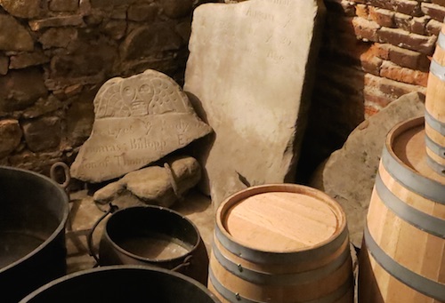
The conference didn't take place in the basement; it's just that it's a photogenic space. So is the root cellar, which contains, along with barrels, kettles, and a zillion folding chairs for outdoor events, the broken headstone of Thomas Billopp, grandson of old Captain Christopher and father of another Christopher Billopp, who was the estate's Tory owner in 1776.

conference house park staten island nyc

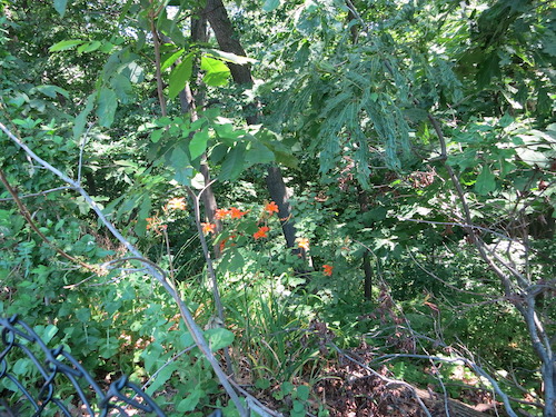
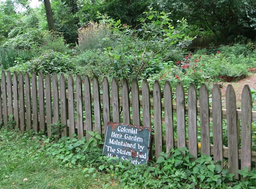
Just outside, the Colonial Herb Garden's sign has rusted. The ladies of the Staten Island Herb Society may still be tending the garden itself, however (though their website doesn't seem to have been updated since 2013). Perhaps it's fitting that their most recent "Herb of the Year" was Elder.

conference house park colonial herb garden staten island nyc

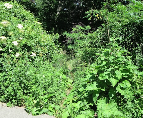
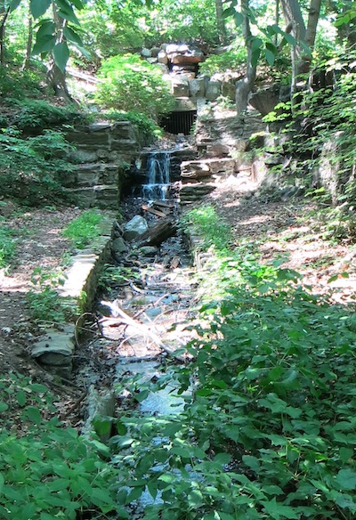
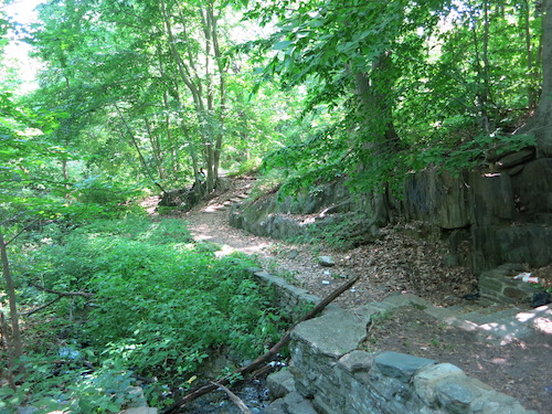
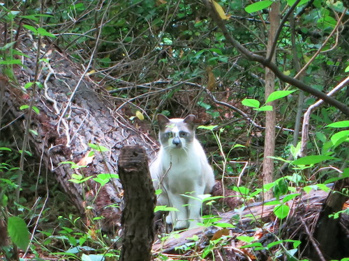
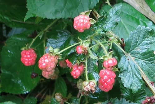
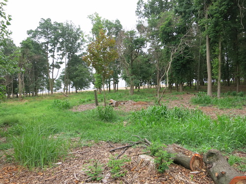
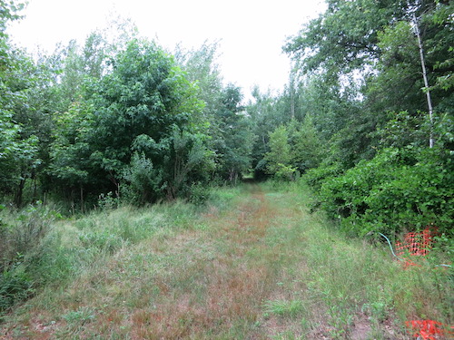
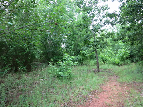
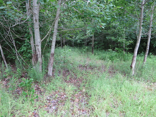
There's more to Conference House Park than house and garden. An unmarked but well-maintained path leads through dense, cat-guarded tangles of trees, brush, and raspberries to another historic structure, the H. H. Biddle House.

conference house park staten island nyc
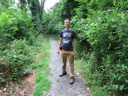
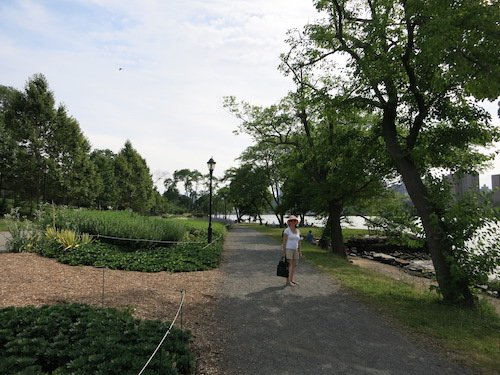
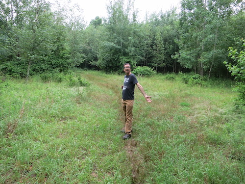
Yours truly at Conference House Park
conference house park staten island nyc

Captain Henry Hogg Biddle built this Greek Revival house around 1845. Biddle ran a ferry between here (the southern end of Staten Island, otherwise known as Tottenville) and Perth Amboy, New Jersey. He also owned Biddle's Grove, "a summer resort for temperance groups," the Conference House website soberly explains. The house looks the same from the back and the front. It's closed for renovations and painting, but the back door was open and there seemed to be activity inside.

conference house park biddle house staten island nyc

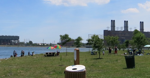
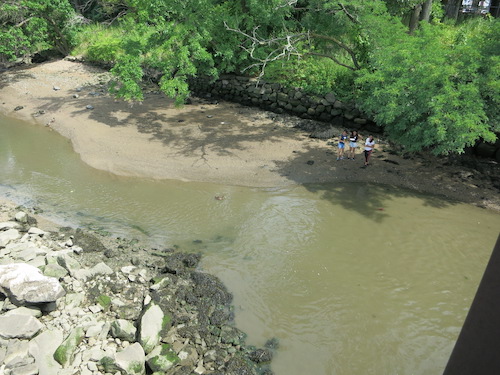
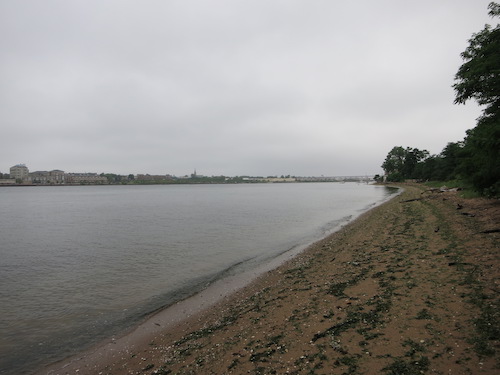
Since we're by the water, it's no surprise that various Captains figure in the history of this park. The Biddle House stands atop a slope that runs down to where the Arthur Kill opens out into Raritan Bay.

conference house park staten island nyc

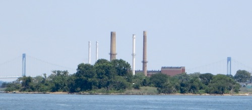
In this view looking north, too small to see in this resized photo, is the Outerbridge Crossing to New Jersey – one reason there's less need for Biddle's ferry services today.

conference house park staten island nyc
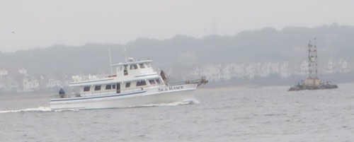
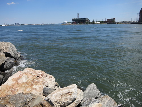
No significance to this. I just like taking pictures of boats.

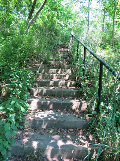
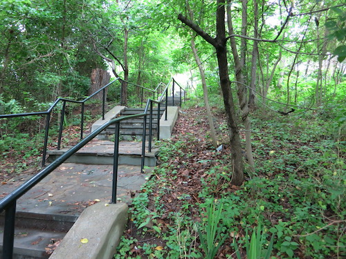
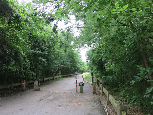
We climbed back up to the park, hiked back through the woods to the main entrance, said goodbye to Conference House Chuck (or Willie the Whistle-Pig), and peeked up this nice walking/biking path as a gentle drizzle fell.

conference house park staten island nyc

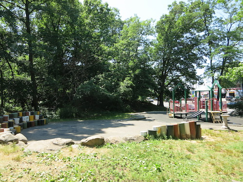
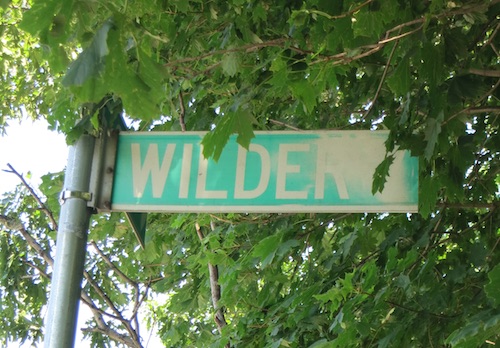
Then we headed down to Billop Ave., where the Lenape Playground meets a stretch of the park that runs along the south coast of the island.

conference house park staten island nyc

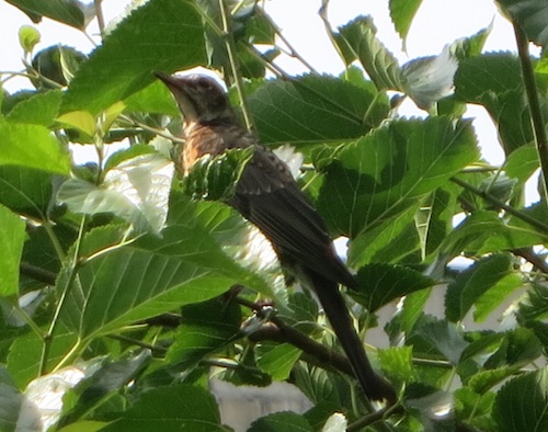
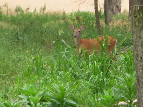
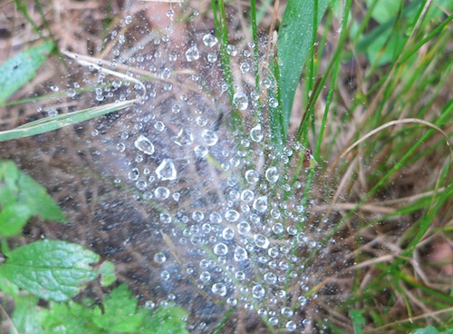
Here we spotted our final wildlife friend of the day.

conference house park staten island nyc

All photos © Jon Sobel, Critical Lens Media

Monday, July 18, 2016

Randall's Island Park

In October 2014 I explored the southern part of what's now (more or less) known as Randall's Island. It comprises the formerly separate Randall's (or Randalls) and Ward's (or Wards) Island land masses, sprawling underneath the multi-span Robert F. Kennedy Bridge.

randalls island wards island nyc
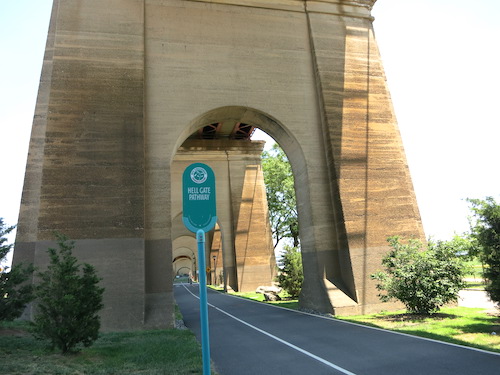
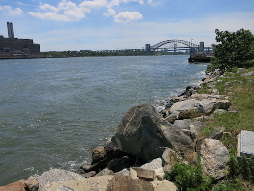
Many people, especially old-timers, continue to use the bridge's old name, the Triborough, which gives you an idea of Randall's Island's location: at the intersection of three of New York City's boroughs. The Bronx lies to the north, over a narrow channel called the Bronx Kill. Queens stretches to the east, over the rushing waters of Hell Gate. To the west is Manhattan, over an arm of the Harlem River.

On July 4 we headed to the north end of the island for a salt marsh tour advertised by the Parks Department. It was the perfect excuse for a trip to see the areas I didn't get to in my previous post. That time, I'd reached the island by walking over the pedestrian Ward's Island Bridge from Manhattan at 103rd Street. This time, since we were aiming at the far north end, we took the M35 bus from Lexington Avenue and 125th Street.

The bus dropped us near the arched Hell Gate Bridge and Railroad Viaduct, which will be 100 years old in 1917. The Parks Department has recently created a walking and bicycle path underneath the span called the Hell Gate Pathway.

hell gate pathway randalls island wards island nyc

(There's nothing devilish about Hell Gate, except the dangerous currents. The name comes from the Dutch hellegat, meaning "bright strait" or "clear opening" – although, funnily enough, when I enter "hellegat" into Google Translate and tell it to translate from the Dutch, it comes up with "hellhole." Go figure.)

As it happened, there'd been a mixup at the Parks Department, and at first no one showed up to give the salt marsh tour, leaving about a dozen urban explorers in the lurch. But one intrepid visitor called the department and shortly thereafter, the Deputy Administrator of Randall's Island Park arrived in an electric cart to save the day.

One thing he explained that I found useful were the island's confusing names. Before the City obliterated the channel separating the two islands with landfill, the northern segment was Randall's, the southern Ward's. Now the Parks Department is normalizing the properties to be called Randall's Island overall, with just one numbering system for the dozens of ballfields spread over the expanse.

randalls island wards island nyc

The Bronx Kill Salt Marsh we'd come to see lies on the northern shoreline, with ballfields just across the path.

randalls island wards island bronx kill salt marsh nyc

The City constructed the marsh in 2008-2009 to compensate for habitat lost in Manhattan's Riverside Park when a Greenway link for bicyclists and pedestrians was constructed projecting over the Hudson River. New York City requires these sorts of environmental mitigations. The results can be surprisingly unrelated to the causes.

randalls island wards island bronx kill salt marsh nyc

Just west of the Bronx crossing, you can hoof it down to the Kill, look across the water and see railroad cars lined up on a spur of track, waiting to take supplies to and from the New York Post and Wall Street Journal printing plant.

randalls island wards island bronx kill salt marsh nyc

To the east, people fish and picnic in the reconstructed Sunken Meadow section of the park, which the City opened in 2010.

randalls island wards island bronx kill sunken meadow picnic area nyc

The coastline here provides a good view of North Brother Island (pictured below) and South Brother Island. North Brother Island's hospital buildings, where Typhoid Mary was confined for many years, are now in ruins and mostly concealed by vegetation, but the smokestacks still protrude into the sky. Now off-limits to most visitors, it's maintained as a bird refuge and a "Forever Wild" site.

randalls island wards island bronx kill sunken meadow north brother island nyc
North Brother Island

Rounding the northeast corner of the island and continuing south, it's easy to see how Hell Gate got its reputation as a rough spot for navigation.

randalls island wards island bronx hell gate nyc
The rough waters of Hell Gate

Hell Gate Bridge was the longest steel-arch bridge in the world when it opened 100 years ago, in 1916. It current paint job – a unique color called "Hell Gate Red" – comes from a 1990s refurbishing. (I got closer to the bridge on my earlier visit.)

randalls island wards island bronx hell gate nyc
Looking south to Hell Gate Bridge

After the salt marsh tour, we headed back to the Viaduct for some shade. The steel beams make a geometric wonderland above. I don't know if this is Hell Gate Red, though. It's more of a lavender.

randalls island wards island bronx Hell Gate Bridge and Railroad Viaduct nyc

We took a quick walk through the Little Hell Gate Salt Marsh on the west side of the island, roughly where a channel used to separate Ward's and Randall's Islands. (More photos of this marsh are at my earlier post.)

randalls island wards island bronx nyc

Flowers bloomed and birds did their thing in the Native Plant Garden.

randalls island wards island bronx nyc

randalls island wards island bronx nyc
Juvenile American Robin on Randall's Island

It's a nice walk down to the Ward's Island Bridge along the west side of the island, which we crossed to return to Manhattan.

randalls island wards island bronx nyc

There's a great deal more to Randall's Island/Ward's Island than concerts at Icahn Stadium and grassy ballfields. And now you can walk there from The Bronx as well as from Manhattan and Queens. Or take a bus. Still never been there? You've got fewer and fewer excuses.

All photos © Jon Sobel, Critical Lens Media

Friday, July 8, 2016

Seton Falls Park

Waterfalls? In New York City? Seton Falls Park beckoned, so I climbed on a No. 5 train and rode it to the last stop in the Bronx to investigate.

It was a long haul, especially on a weekend when the No. 5 was really the No. 2 and vice versa (or something). But after a frustrating 10-minute pause just before the final station at Eastchester-Dyre Ave., I climbed down from the platform onto East 233rd Street in Eastchester – the Bronx neighborhood, not the identically named town in Westchester County to the north.

Hiking west a few blocks, I reached the northeast corner of the park, where the entryway looked promising.

seton falls park bronx nyc

Seton Falls Park is a squarish 35-acre tract described by the Parks Department website as "a woodland, wetland, and bird sanctuary" that "derives its name from the prominent waterfalls built in the park by the Seton family." I wondered how "prominent" the waterfalls could be.

Heading in from the northeast, the paved path ends at a circle. Along the way I saw the first of numerous trail-marker boulders, which as far as I know are unique among NYC's parks.

seton falls park bronx nyc

I didn't see the two dirt paths that extend from the circle, they're so overgrown; I came back to find them later, after I'd studied the map.

seton falls park bronx nyc
You can see how I missed this path the first time.

I went back out to East 233rd Street and continued west to the park's northwest corner, which promised a playground (where, on this beautiful weekend afternoon, finding people seemed likely) and the famous falls.

At the moment, the playground was just as deserted as those nearly impassable trails I'd failed to spot.

seton falls park bronx nyc

I won't hold you in suspense. I give you: Seton Falls.

seton falls park bronx nyc

A detail:

seton falls park bronx nyc

The best-known member of the Seton family is Saint Elizabeth Seton (1774-1821), founder of the American Sisters of Charity, and the first native-born American citizen to be canonized by the Roman Catholic Church. Many people, though – or at least one person (me) – know the Seton name from Seton Hall University, a Catholic institution in New Jersey founded in 1856 by Elizabeth's nephew James Roosevelt Bayley, the Bishop of Newark. This cousin of Theodore Roosevelt named the school in honor of his sainted aunt.

Coincidentally (I think), another Roosevelt, also named James, once owned the property that now includes Seton Hall Park. Saint Elizabeth's son William married into the family that owned it next, one of whose projects was to dam Rattlesnake Creek, which ran through the tract, thus creating the modest waterfalls we see today.

seton falls park bronx nyc

In the early 20th century the city acquired much of the onetime estate, intending to build a hospital for patients with contagious diseases. Years of community opposition to that plan led to the birth of Seton Falls Park.

seton falls park bronx nyc

You may be wondering: Here we are at Rattlesnake Creek; what happened to the rattlesnakes?

Probably sometime around 1900, the last rattlesnake left town, joining the other former residents, the Siwanoy Indians, in exile or death. In an entry on Rattlesnake Brook, Forgotten New York cites Bronx historian John McNamara as explaining that Eastchester's original families "signed a pact devoted to the destruction of the rattlesnake, and hit upon an unusual method to carry this out. They would set their pigs on them. Pigs find snakes of all types a delicacy, and their thick hide and layers of fat make them largely immune to snakebite."

I'd sure like to get a look at that pact.

To go with its miniature waterfalls, the park has miniature cliffs and modestly varied terrain. There's information about the terrain and the vegetation on this fact sheet from the Metro Forest Council.

seton falls park bronx nyc

Naturally, I'm partial to the natural areas. But there are sports facilities too. No one was on the tennis courts, but the sprinkler was drawing a few fans.

seton falls park bronx nyc

At one edge of the park, masked avengers tended to the landscaping. At another, where wildflowers bloomed, the aptly named Wilder Avenue met its end.

seton falls park bronx nyc

A final note: A number of online sources say that a Revolutionary War battle took place on these grounds. The Parks Department website notes that as part of the military action in The Bronx and lower Westchester, "One battle occurred in what is now Seton Falls Park in 1781, as the British retreated under fire by the patriots." My admittedly fairly cursory Internet research hasn't turned up any details or corroboration. If you have any knowledge of this bit of history, please leave a comment below.

All photos © Jon Sobel, Critical Lens Media