Search This Blog

Wednesday, November 20, 2013

Rainey Park

Last weekend's visit to the weirdness that is Socrates Sculpture Park also included a stop at nearby Rainey Park, whose comparative normalcy was almost a shock.

Between the two parks is a huge Costco, and threaded along the riverfront is a walkway maintained by the retailer for the public. The segment of the public most interested in this amenity seems to be the fishing segment.

While Costco isn't known for aesthetically tasteful facilities, it did invest in some nice "street" lamps for its walkway, which I'm happy to acknowledge here. It wouldn't surprise me if I were the only one ever to do so. But I think picturesque lamps add something significant to an outdoor area.

Speaking of aesthetics, I don't know if they planned it, but this blazing red bush goes well with the Costco-red stripe above it.

Once you come around the corner of the giant building, Rainey Park appears, complete with paved biking and walking paths and its own riverfront amble. This waterfront spot honors Dr. Thomas Rainey, "Father of the Queensboro Bridge," who, beginning after the Civil War, spent decades of effort and money advocating for a bridge across the East River between Manhattan and Queens, a vision finally realized when the Queensboro Bridge (recently rechristened the Ed Koch Queensboro Bridge) opened in 1909.

Down on the rocks, a pair of ducks kept watch over their brood of youngsters.

Late-fall foliage clung to some of the trees in mid-November, keeping my mood colorful.

Postscript: The same can't be said, alas, for the streetscape further south in Long Island City near MOMA PS1. After seeing Rainey Park we bussed-then-hiked there for some highfalutin lunch at M. Wells (mine included duck parts, lest you worry that the circle be broken). After lunch we walked by the famous 5Pointz graffiti building, not realizing that just three days later the work created there by hundreds of artists over the past two decades would be summarily whitewashed over in preparation for the tearing down of the building.

According to the owner, the whitewashing is meant to lessen the pain of the demolition, as watching the walls come tumbling down with the art still on them would be too painful to imagine. A fair point. Nonetheless it's a sad end for one of New York City's cultural landmarks.

Tuesday, November 19, 2013

Socrates Sculpture Park

One of New York City's most eccentric parks is a four-acre tract of scrubby grass, half sculpture garden and half playground, by the East River in Long Island City (or, according to some, in Astoria), Queens.

Founded in 1985 by a group of artists led by sculptor Mark di Suvero, Socrates Sculpture Park is named for the ancient Greek philosopher and teacher, and in honor of Astoria's large Greek-American population.

On Saturdays, at least until November, it hosts a Farmer's Market. There's also a fancy-coffee vendor. On the ground, on a Saturday in late fall, there's more mud than grass. All this only adds to the anything-goes character of the place. Ungenerously, a commenter on this blog post called it a "glorified dog-run," but I suppose that's apropos on a blog called "Queens Crap."

Each year the exhibits change. This season's sculptures lend themselves to play. How can you resist a sculpture you can slide down? (Also, what kid doesn't love a muddy field?)

Bigger kids too find this place hard to resist.

A bit closer to the river it feels more parklike, less playgroundy.

And then there's the waterfront itself.

One thing I've learned from internet searches about this neighborhood: I'm not stepping into the quagmire of what's Long Island City, what's Astoria, and how Ravenswood fits in to it all. People get all in a huff about their neighborhood names and histories. What I do know is that Hallet's Cove is the name for the inlet on whose southern border you will find this quirky mudfield called Socrates Sculpture Park (though you won't see the Hallet's Cove moniker on Google Maps).

In any case, and whatever neighborhood you insist you live in, it's probably best to follow the advice written on the rock in the lower right of the photo.

Wednesday, November 13, 2013

Highbridge Park

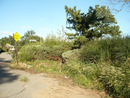
New York has beautiful, fully maintained parks like Central Park. It has parks that are barely developed at all, like Calvert Vaux Park. And it has parks that fall somewhere in between. One such is Highbridge Park, a long, strange strip on the eastern edge of upper Manhattan.

A couple of preliminaries: the park's southern tip is at 155th Street, near the eastern edge of the island – but it's West 155th Street. (I never realized that once you get above the low 130s, there are only "West" addresses; Manhattan does not have an East 155th Street.) Anyway, across the street is the Hooper Fountain, an 1894 basin and column originally placed here to quench the thirst of the passing horses. Now it seems oddly positioned, and it's definitely mostly un-noted by the passing hominids.

Across the street, I thought at first this staircase might be an entrance to the park. But it's just a staircase, one that goes very, very far down. And it does presage the steep drops at the edge of the park.

At the foot of the park is a triangular grassy area with the spectacular name "Sugar Hill Luminaries Lawn." When I hear "Sugar Hill" my first thought is of the early rap group The Sugar Hill Gang, but the Sugar Hill neighborhood, which extends north to just about here, was a locus of the Harlem Renaissance of the 1920s. The whole neighborhood is on the National Register of Historic Places, as an informational sign points out.

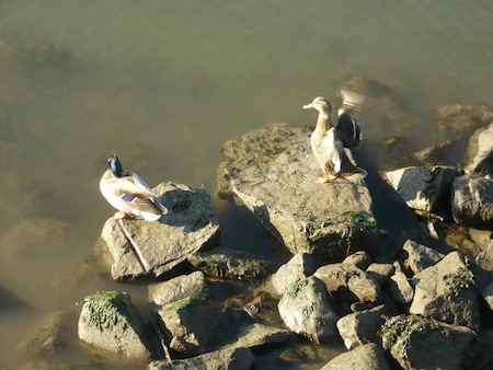
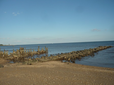
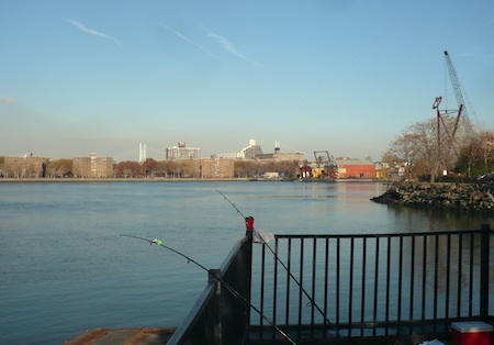
Highbridge Park starts a couple of blocks inland. But after it zooms north along Edgecombe Ave. for a for blocks, it's no longer inland; the edge of Manhattan cuts inward, after which there's nothing between the park and the Harlem River but a steep drop and the Harlem River Drive. Even before you've entered the main body of the park, the terrain's rocky muscles make themselves dramatically known.

This area, known as Coogan's Hollow, still echoes with the crack of the bat, as the Polo Grounds stadium was here. If you look closely you can see on the landing of this staircase (now closed for reconstruction) an acknowledgment of the New York baseball Giants.

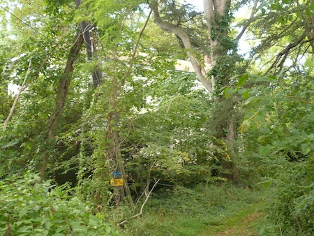
Entering the park proper you find that this stretch of it consists only of a trail, which narrows eerily as you walk further north.

Side effects may include a claustrophobic, no-way-out feeling, as you're hemmed in by a rock wall to your left and a steep drop to your right.

At around 165th Street, a large fallen tree blocked the trail. We could have limboed under it but it seemed to be telling us to turn back now, Dorothy, so we doubled back and then walked north again alongside the park on Edgecombe Ave., reentering at the next opportunity.

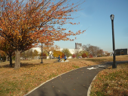
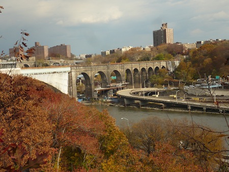
Amid playgrounds and playing fields appeared the mouth of the High Bridge Access Trail, a circa-2008 bike and walking path much more welcoming than the mostly deserted (except for one homeless guy) stretch of confined trail we'd just been on. The Access Trail winds north to the famous bridge which gives the park its name and beside it the old High Bridge Water Tower.

Constructed between 1837 and 1848, the High Bridge is New York's oldest bridge connecting two boroughs (at that time, towns). According to Forgotten New York, which has some good pictures and background on these landmarks, the walkway over High Bridge "was closed [in 1960], never to again reopen, because of local knuckleheads throwing objects from the bridge onto Circle Line boats in the Harlem River." What Forgotten couldn't have known back in 1999 was that in the Bloomberg era a plan to re-open the bridge walkway would form. In fact, the reason I've left High Bridge Park to near the very end of my survey of Manhattan parks is that I've been waiting for that reopening, which was announced for summer 2013. It didn't happen, and I got tired of waiting, so here we are.

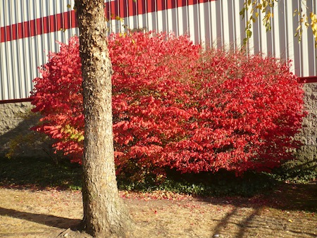
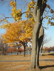
Approaching the bridge are some impressive outcroppings of Manhattan schist, and the fall colors were eye-catching.

The bridge itself was a conduit for water from the Croton Aqueduct. The Bronx side still has the original Roman-style stone arches.

From the closed-off site of the bridge work, we had to exit to the street and walk a bit further north to re-enter and see a bit more, first passing by the front of the Highbridge Play Center, which has a big pool behind it and playgrounds in back.

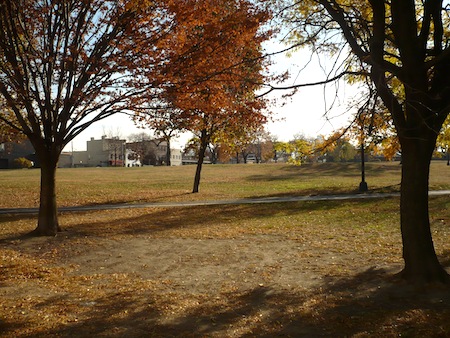
Adjoining some playing fields is a large rocky hill. I summited it and got the brief sensation of having reached the top of a mountain.

On this very changeable day, rain was coming in. Exploring the northern half 
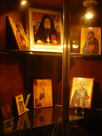
of Highbridge Park will have to wait for another day – maybe the day the bridge walkway finally does reopen.

Walking back to the subway, we encountered one of those wonderful New York City serendipities: a Greek food festival and bazaar at the Saint Spyridon Greek Orthodox Church, complete with live music. So we didn't even have to go home hungry, thirsty, or spiritually unfulfilled.
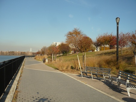
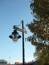
Tuesday, September 24, 2013

Bayview Terrace Park

Our attempt to visit Bayview Terrace Park in Staten Island was a failure, like our try for the Olmsted-Beil House, though of a somewhat different kind. The latter hasn't been developed or opened to the public. The former, while of less historical interest, is more of a mystery, as we could neither enter nor get much sense of what (if anything) we were missing. The nearby Dead End sign turned out to be an appropriate touch.

Viewed through its gate, the site is obscured by tall grass topped by a yellow sign bearing an even less promising message. You can see the bay, though. As the Parks Department website says, "The watery vista and 17-foot drop to the beach below clearly show the origins of Bayview Terrace's name."

Intriguingly, the website goes on as follows: "The park itself extends out through the beach and into the water. Nearly 90 percent of the parkland lies under the water."

So that's the secret of Bayview Terrace Park: it lies beneath the waves.

The endless variety of New York City's parks never ceases to amaze me.

And here's another indication of a mysterious past: "Though the seaside road remains on maps, in reality, it has washed away." True enough, my 1994 Hagstrom atlas does show a road right along the waterline, though one without a name.

Approaching the gate, we found the park locked, like a community garden during unattended hours. And it is, in fact, a garden, though it's also Parks property, a garden "dedicated to natural methods of cultivation" and whose tending "remains in the hands of the volunteer gardeners," which explains its obviously part-time hours.

These peapods looked as anxious to get out as we were to get in, but to no avail. Maybe another day. Meanwhile, every time I visit Staten Island I become more convinced that the place will never give up all its secrets.

Sunday, September 22, 2013

Blueberry Park and the Beach at Mayberry Promenade

City parks don't come much more nondescript than Blueberry Park, a public patch of dirt, grass and trees inserted into the private Atlantic Village community in Eltingville, Staten Island. Here it is, in all its pretty-much-nothingness.

As you might imagine, I spend a good deal of time on the New York City Parks and Recreation website, which is loaded with a great deal of useful information. Rarely if ever have I come across a park page there with absolutely nothing on it. If you want to know what that looks like, visit Blueberry Park online.

Fortunately for the residents, Atlantic Village also has its own beach, which runs parallel to a street colorfully called Mayberry Promenade. (There's also a Strawberry Lane here. It's a berry theme; there are no actual berry patches that I know of.)

But as the first anniversary of Superstorm Sandy approaches, the aftermath is evident along the strand.

This was once a nicely laid out entryway. The staircase is still navigable but partially crumbled.

The jetty has certainly seen better summers.

Across the bay is New Jersey, which was hit just as badly. But if you simply look out over the water, all looks peaceful - same as it ever was.

Thursday, September 19, 2013

Olmsted-Beil House

Most of these posts recount successful visits to parks, but it's fun to document failures as well. We heard that the Parks Department had taken over the Olmsted-Beil house on Staten Island, where Frederick Law Olmsted lived and worked, and thus we imagined that it, or at least its grounds, had opened to the public. How wrong we were!

The property is guarded by beefy, barking dogs (thankfully behind a neighbor's fence) and ferocious mosquitoes, so of course we didn't dare intrude beyond the "No Trespassing" sign that hung incongruously with the pleasantly welcoming historical information sign. These photos were taken by my top-secret drone camera. Even so, getting a good view of the house itself through the thick overgrowth isn't really possible.

This beat-up old annex is a little more accessible, if you dare to access it.

In the late 1600s the original land grantee, Petrus Tesschenmakr, built a one-room house which, according to the historical sign, "still survives as part of the basement" of the house that Olmsted inhabited in the mid-19th century. ("Tesschenmakr" might mean "bag-maker" in Dutch, or some old version of Dutch. On the other hand, it might not.) Olmsted called the property "Tosomok" (and what does that mean? I haven't found out, so I'm wildly postulating that Olmsted made up a Native American-sounding version of "Tesschenmakr") and turned what had been a wheat farm into a tree nursery, planting cedars of Lebanon, some of which still grow there, although someone better than I at identifying trees will have to certify whether this gnarly survivor is one of them:

Bobbing around back, my drone camera got a good view of how very un-maintained this property is.

The Parks Department has owned the house since 2006, a very short time in the history of the house but long enough, you'd think, to do some clearing and provide some public access. You'd think. That the "perpetual protection" indicated in the historic sign should be provided by hostile dogs and bloodthirsty insects was a surprise to me. Anyway, for now we'll have to settle for black-ops penetration and satellite views.

If you squint at the lower right corner of the above satellite image, you can see Google offering a "Report a problem" link. I have a problem: the Olmsted-Beil House isn't open. What do you think, should I click?