I grew up on Long Island, which is criss-crossed by narrow, sometimes winding highways called parkways. These roads are restricted to passenger cars. Not knowing any better, I assumed that was the way the whole world worked: parkways for cars, other highways (like the Long Island Expressway) for cars and trucks.
Only when I read about the lives of Robert Moses (mostly through Robert Caro's masterful book The Power Broker) and Frederick Law Olmsted did I learn why the roads I knew so well as a child passenger and teenage driver were called parkways. These roads were conceived in Olmsted's original vision as beautiful landscaped routes leading from park to park, and meant to have parklike qualities themselves: green, picturesque, secluded from the cities and towns and neighborhoods through which they passed.
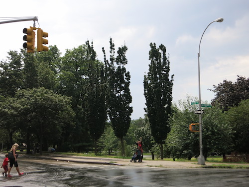
Cypresses (I think) along Mosholu Parkway in The Bronx
Olmsted's 19th-century vision fed Moses's 20th-century ambitions: Nowhere is Moses's automobile-centrism more pronounced than in the parkway system, with which the New York metro area remains stuck. The LIE gets choked with traffic because trucks can't drive on Long Island's other east-west highways. (The parkway lanes are too narrow, and trucks would crash into the picturesque stone overpasses anyway.) In the north-south dimension, there are no real highways for trucks at all, only parkways; commercial vehicles must make do with the occasional wide route with traffic lights.
Meanwhile the cars using the parkways have to negotiate their narrow, winding lanes at full speed – except when the parkways get just as jammed as the Expressway. Worst of both worlds.
 Parkways course through the city and Westchester County as well as Long Island. Moses tried his darnedest to cut Manhattan residents off from most of their waterfront when he built the Henry Hudson Parkway, the Harlem River Drive, and the FDR Drive. He connected Brooklyn and Queens with the ridiculously narrow and winding Jackie Robinson Parkway (formerly called the Interboro). Most of the Grand Central Parkway, the main alternative to the LIE in Queens, is off-limits to commercial vehicles.
Parkways in The Bronx and Westchester include the Hutchinson River Parkway, the Bronx River Parkway (probably my least favorite highway in the whole region), the Sprain Brook Parkway, and the Taconic Parkway.
But The Bronx is also home to a parkway with a different character. Built in the 1930s, the three-mile Mosholu Parkway really does link parks: Van Cortlandt Park at its northwest end, the New York Botanical Garden (technically part of a huge park called Bronx Park) to the southeast.
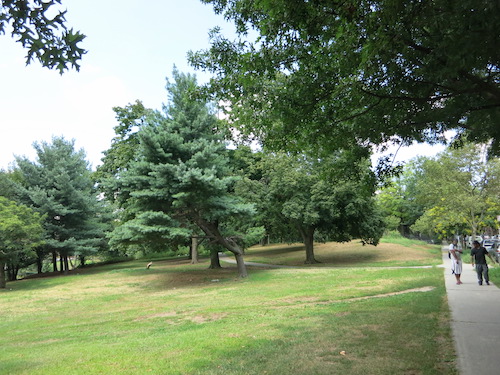
The Mosholu itself is also a strange sort of road. Wikipedia has to twist terms awkwardly to describe it as a "hybrid freeway-standard parkway and grade-level roadway."
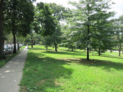
Along East Mosholu Parkway North, with a glimpse of the parkway's main travel lanes on the far right
"Mosholu," explains the Parks Department website, "is an Algonquin name meaning 'smooth stones' or 'small stones,'" which was the name of a "nearby creek now known as Tibbett's Brook." We walked along Tibbetts Brook in Van Cortlandt Park, through which an extension of the Mosholu Parkway also runs.
When it was laid out in 1888, Moshulu Parkway actually ran alongside a waterway, "known to the Dutch as Schuil (anglicized as School) Brook" according to Forgotten NY, meaning "hidden creek." That name is appropriate, as this stretch of the brook was buried before the parkway was built. The visible part survives as Tibbetts Brook, just to the north in Van Cortlandt Park and beyond, in Tibbetts Brook Park in Yonkers.
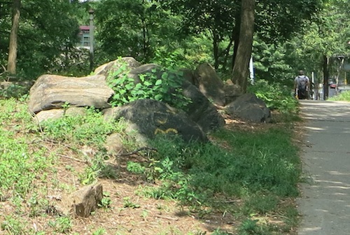
The natural terrain asserts itself in places.
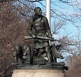
There's more "park" to Mosholu Parkway than just greenery, including sports and play areas and a doughboy sculpture by Jerome Conner (or Connor). Mosholu Parkway really is a hybrid: a roadway that's also a park.
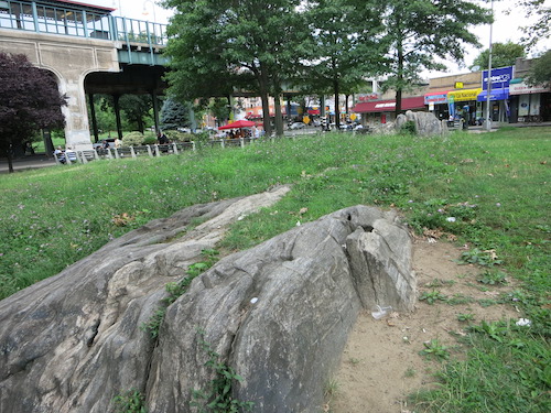
More natural terrain by the Mosholu Park subway station at Jerome Ave.
All photos © Jon Sobel, Critical Lens Media, except doughboy sculpture image courtesy of NYC Parks
No comments:
Post a Comment